May rainfall
May averages 4.40 inches at the airport in the 1991–2020 record. Prepare alternate road routes before spring storms.
SAN ANTONIO EMERGENCY PREPAREDNESS GUIDE
Plan for flash flooding, extreme heat, severe storms and winter outages. Find road-closure resources, CPS Energy and SAWS contacts, local weather charts and household planning tools.
Bexar County · Texas

This guide covers San Antonio, primarily in Bexar County. Verify your county and utility provider for your address. Airport averages and county resources describe a wider area than any one neighborhood. Historical data and planning tools; check official sources for current conditions.
View sources ↗CHOOSE A STARTING POINT
01 / UNDERSTAND LOCAL RISKS
See the long hot season and the months that receive more rain on average. Flash flooding can happen outside those wetter months.
San Antonio International Airport · NOAA 1991–2020
Monthly averages, not a forecast. Rainfall includes the water equivalent of precipitation. Days reaching 90°F are not heat-index days.
| Month | High °F | Low °F | Rain inches | Days ≥90°F |
|---|---|---|---|---|
| January | 63.3 | 41 | 1.96 | 0 |
| February | 67.5 | 45.1 | 1.74 | 0.2 |
| March | 73.8 | 51.8 | 2.31 | 0.5 |
| April | 80.3 | 58.4 | 2.42 | 3.2 |
| May | 86.6 | 66.4 | 4.4 | 11.8 |
| June | 92.4 | 72.7 | 3.28 | 24 |
| July | 94.9 | 74.7 | 2.41 | 28.5 |
| August | 96 | 74.9 | 2.15 | 28.8 |
| September | 90.1 | 69.6 | 3.88 | 19.7 |
| October | 82.2 | 60.4 | 3.75 | 5.6 |
| November | 71.7 | 49.8 | 2.08 | 0.1 |
| December | 64.7 | 42.4 | 2 | 0 |
May averages 4.40 inches at the airport in the 1991–2020 record. Prepare alternate road routes before spring storms.
Average daily highs exceed 90°F from June through September. Include a place with working air conditioning in your outage plan.
A mild monthly average can hide a short, severe freeze. Keep winter supplies and utility contacts ready before the forecast changes.
02 / UNDERSTAND LOCAL RISKS
A short trip can become dangerous when water covers a crossing. Save the official closure resources for the routes you use.
Use the city’s street-closure page to reach emergency closure information and Bexar Flood. Decide on a route that avoids low crossings.
Turn around. Do not use the depth you remember, a familiar curb or another driver’s attempt to decide that a crossing is safe.
Wait in a safe place or use a confirmed dry alternative. A navigation app’s suggested shortcut may also cross a creek.
Check emergency street closures ↗ · Read city flood guidance ↗
03 / UNDERSTAND LOCAL RISKS
Prepare a destination and a ride, especially for anyone whose home gets hot quickly or who needs powered equipment.
Check the city’s hot-weather resources for cooling options. Confirm current hours, accessibility and pet rules directly. Choose a second destination in case the first closes or also loses power.
Arrange cooling-equipment maintenance and keep drinking water available. Write down the small devices that need backup charging.
Plan shade, water and a cooler part of the day for outdoor tasks. Check the forecast before waiting outside for a ride.
Agree on a check-in routine. Discuss medical equipment backup with the equipment provider before an outage.
04 / UNDERSTAND LOCAL RISKS
Electricity and water interruptions need different contacts and supplies. Confirm both providers on your bills.

Save 210-353-4357 and the outage center. Update account contact details if you want utility outage notifications.
For a water or sewer emergency, call 210-704-7297 and press 1. Check the water outage map if service stops unexpectedly.
Store drinking water before an outage. Follow any official water-use or boil-water notice for your address; a restored tap does not by itself cancel an advisory.
Open CPS Energy’s outage center ↗ · Open SAWS reporting and outage resources ↗
05 / UNDERSTAND LOCAL RISKS
Keep a warm destination, drinking water and lighting in the plan even when most winter days are mild.
Use the city’s cold-weather page for places to stay warm and current winter instructions. Libraries and community facilities generally operate on their own schedules; confirm a location is open before leaving.
Ask your property manager or a qualified plumber how to prepare vulnerable plumbing. Check smoke and carbon-monoxide alarms, charge lights, and keep warm layers accessible. Never heat a home with a grill or cooking stove.
Find winter resources and warming locations ↗ · Check VIA service alerts ↗
06 / UNDERSTAND LOCAL RISKS
Your storm shelter and your flood evacuation destination may be different places.
For a tornado warning, use a small interior room on the lowest floor of a sturdy building, away from windows. Mobile-home residents need a sturdy destination and enough time to reach it before the storm arrives. For flooding, follow local instructions and avoid routes through water.
Write down an out-of-neighborhood meeting place, a ride and an alternate route. Check VIA alerts if transit is part of the plan. City alerts include accessible notification options; choose methods that work for your household.
Review tornado shelter guidance ↗ · Find local alert options ↗
07 / BUILD YOUR EMERGENCY PLAN
Choose your household size, supply duration and housing type. Save a checklist and download local contacts with your plan.
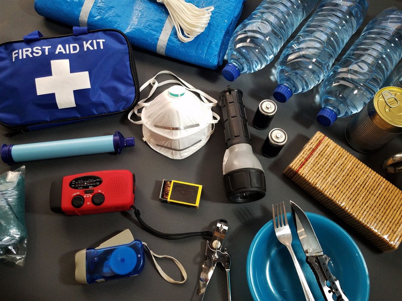
STARTING WATER RESERVE
2 people × 7 days × 1 gallon per day
For people only; add pet and individual needs.
Tracks these tasks only, not a safety score. Choices stay in this browser.
The seven-day setting is a planning scenario. Start with at least one gallon of water per person per day; increase it for heat, pets and individual needs. Read water-storage guidance ↗
Keep a portable bag separate from your home reserve. Add medication instructions, accessibility needs and meeting places to the downloaded worksheet. The checklist tracks tasks you mark; it does not measure whether your home is safe.
08 / BUILD YOUR EMERGENCY PLAN
Choose a month for three practical tasks. These are suggested reminders, not a forecast or a restriction on when hazards can happen.
09 / USE THE TOOLS
Use the power label on each device. This calculator estimates energy use; it does not check electrical compatibility.

| Use | Device | Watts | Hours/day |
|---|
Watts × hours gives daily watt-hours. Battery capacity × usable percentage gives estimated usable energy. Actual runtime also depends on starting surges, inverter limits, battery condition and temperature.
10 / USE THE TOOLS
Compare the seasons before relying on a portable panel for backup charging.
NASA POWER · 2001–2025
The estimate uses monthly average sunlight on a horizontal surface: panel watts × daily irradiation × the percentage retained after losses. It is an approximate daily energy budget, not guaranteed output during a storm.
Shade, nearby buildings, panel angle, temperature and charging limits change the result. Check that the panel and battery are compatible. View the underlying NASA grid data ↗
11 / BUILD YOUR EMERGENCY PLAN
Use local alerts and a second information source. Test reception and batteries before you need them.
Keep the leading zero.
WXK67 · Verify reception where you will use the radio. Radio setup source ↗
SAME filters county alerts on compatible receivers. A basic weather-band radio may only play broadcasts when switched on. Check the model before relying on automatic warnings; the county code does not identify your evacuation zone.
12 / BUILD YOUR EMERGENCY PLAN
Put these links and numbers in your phone and keep a paper copy. Check your utility bill to confirm the correct provider.
Call 911 for immediate danger.
Electric or gas emergency: 210-353-4357. Outage center ↗
Water or sewer emergency: 210-704-7297, press 1. Report a problem ↗
Call 311 for city services; check heat ↗ or winter resources ↗.
13 / UNDERSTAND LOCAL RISKS
These examples show how different emergencies affect everyday life. They are not a forecast or an estimate of your address’s risk.
USGS documented severe flooding on May 25–26, including the San Antonio River and Salado Creek. Planning lesson: keep road decisions tied to current conditions, not the usual depth of a crossing. Read the USGS account ↗
The NWS review describes a February 10–18 period of winter weather across South-Central Texas. Planning lesson: include water, warm shelter and several days of essential supplies. Read the regional review ↗
14 / BUILD YOUR EMERGENCY PLAN
Supplies selected for San Antonio’s local risks and the plans on this page. Start with what you already own.
These are individual products, not a complete emergency kit. Compare capacity, fit and household needs before buying. Cards show the current store catalog; confirm options and availability on the product page.
Browse all emergency supplies →
Keep a five-gallon drinking-water container ready for SAWS interruptions; increase the total reserve for your household and heat-related needs.

 10% off · WINTER10
Storing household water
In stock
$80.95 USD
Choose options & shopCharge phones and small devices for road-closure and utility updates. This small power station cannot replace air conditioning or household heating.
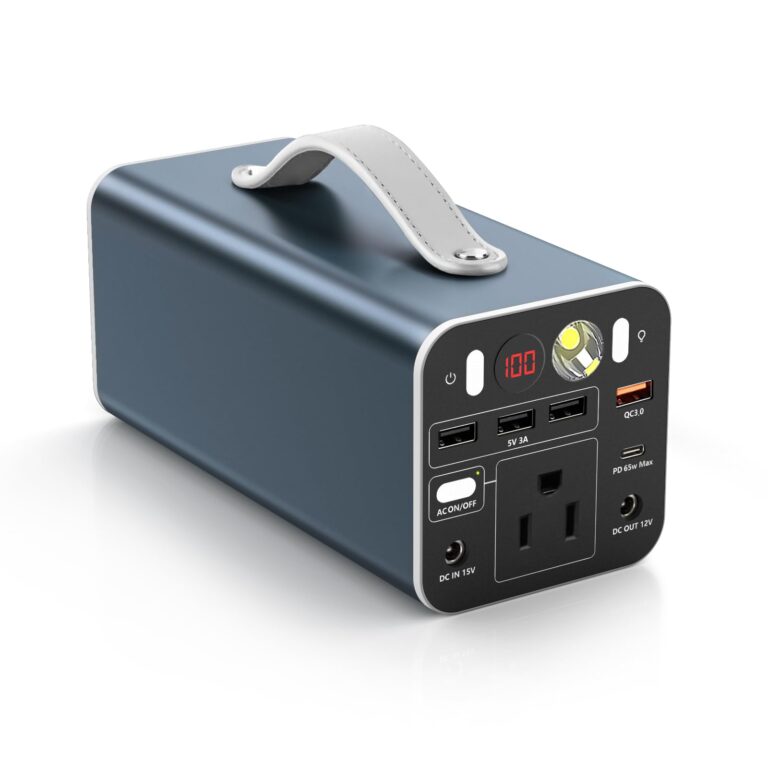

Keep a portable battery reserve for phones, compatible laptops and other small essentials during an outage.
In stock
$179.95 USD
Choose options & shopUse a hands-free light during storm or freeze outages. Keep it charged before severe weather.

 10% off · WINTER10
Keeping your hands free
5.0 (1)In stock
$18.95 USD
Choose options & shopKeep food that requires no stove or preparation water during a combined power and water interruption. Check ingredients and dietary needs.

Compact food reserves that need no cooking or preparation water.
In stock
$84.95 USD
Choose options & shopCarry your pet’s water and bowls when moving to a cooled or warm destination. Confirm that the location accepts pets.

 10% off · WINTER10
Serving pet food and water
In stock
$25.95 USD
Choose options & shopKeep compact blankets in a winter travel bag alongside warm clothing. They do not replace safe indoor shelter.

 10% off · WINTER10
Compact extra insulation
In stock
$25.95 USD
Choose options & shopSOURCES AND COVERAGE
Independent Local Prepper guide. Sources reviewed November 2026. City, county, airport, and regional data are labeled separately. No address-level safety assessment or live alert feed is provided.
San Antonio International Airport, station USW00012921; 1991–2020 monthly station averages, not neighborhood measurements · Checked 2026-11-13
Grid near 29.4241, -98.4936; January 2001–December 2025 monthly daily irradiation averages · Checked 2026-11-13
National household water-storage guidance; increase amounts for heat, pets and individual needs · Checked 2026-11-13
Official emergency updates, phone-alert guidance and accessible alerts · Checked 2026-11-13
City updates and Accessible Hazard Alert System registration · Checked 2026-11-13
City flood safety and preparedness links · Checked 2026-11-13
Links to emergency street closures and Bexar Flood; conditions change · Checked 2026-11-13
City cooling resources and heat preparation · Checked 2026-11-13
Winter planning, places to stay warm and service contacts · Checked 2026-11-13
Outage map and notifications; electric/gas emergency telephone 210-353-4357 · Checked 2026-11-13
Water/sewer emergency and outage reporting: 210-704-7297 · Checked 2026-11-13
Bus detours and service disruptions · Checked 2026-11-13
Bexar County SAME 048029; WXK67 at 162.550 MHz; other counties require their own code · Checked 2026-11-13
May 25–26, 2013 flooding in the city; historical observation · Checked 2026-11-13
Regional February 2021 winter event; not a forecast · Checked 2026-11-13
National guidance on avoiding flooded roads and moving water · Checked 2026-11-13
National guidance for sturdy buildings, mobile homes and vehicles · Checked 2026-11-13
Photo: San Antonio Skyline at Night (12216535856).jpg by Jonathan Cutrer from San Angelo, United States, 2014-01-29 22:43. CC BY 2.0. Display cropped.

